


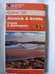
Alnwick and Amble by Ordnance Survey
This map is part of the Ordnance Survey's Explorer series designed to replace the old Pathfinder map series. At 1:25,000 scale this detailed map shows a host of attractions including gardens which are open to the public, nature reserves and country parks as well as all official footpaths, bridleways, roads and lanes. Other facilities covered include: camping and caravan sites, picnic areas and viewpoints, selected places of interest, rights of way information for England and Wales, National Trail and Recreational Path routes, and selected tourist information. The main advantages of this map are the geographical design of the sheetlines to capture the best local coverage, and the coverage of a larger area for value for money. The series is aimed mainly at the experienced map user but can be used by tourists and locals alike.| SKU | Nicht verfügbar |
| ISBN 13 | |
| ISBN 10 | |
| Titel | Alnwick and Amble |
| Autor | Ordnance Survey |
| Serie | |
| Buchzustand | Nicht verfügbar |
| Bindungsart | |
| Verlag | |
| Erscheinungsjahr | |
| Seitenanzahl | |
| Hinweis auf dem Einband | Die Abbildung des Buches dient nur Illustrationszwecken, die tatsächliche Bindung, das Cover und die Auflage können sich davon unterscheiden. |
| Hinweis | Nicht verfügbar |
View All Editions
Filter
Applied Filters (0)
Sortieren nach:
Loading editions...