


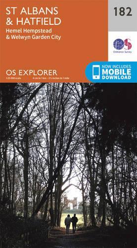
St. Albans and Hatfield by Ordnance Survey
OS Explorer is the Ordnance Survey's most detailed map and is recommended for anyone enjoying outdoor activities like walking, horse riding and off-road cycling. The OS Explorer range now includes a digital version of the paper map, accessed through the OS smartphone app, OS Maps. Providing complete GB coverage the series details essential information such as youth hostels, pubs and visitor information as well as rights of way, permissive paths and bridleways.-
 The English Lakes
-
 Purbeck & South Dorset, Poole, Dorchester, Weymouth & Swanage
-
 The Peak District, White Peak Area, Buxton, Bakewell, Matlock & Dove Dale
-
 Brecon Beacons National Park / Parc Cenedlaethol Bannau Brycheiniog - Western Area / Ardal Gorllewinol
-
 Exmoor, Barnstaple, Lynton, Minehead & Dulverton
-
 The Peak District
-
 The Cotswolds, Burford, Chipping Campden, Cirencester & Stow-on-the Wold
-
 Brecon Beacons National Park / Parc Cenedlaethol Bannau Brycheiniog - Eastern Area / Ardal Ddwyreiniol
-
 New Forest, Southampton, Ringwood, Ferndown, Lymington, Christchurch and Bournemouth
-
 The English Lakes - North-Western Area, Keswick, Cockermouth & Wigton
-
 South Devon, Brixham to Newton Ferrers
-
 South Pembrokeshire / De Sir Benfro
-
 The English Lakes - South-Western Area, Coniston, Ulverston & Barrow-in-Furness
-
 Yorkshire Dales South & Western
-
 Lyme Regis and Bridport
-
 North York Moors - Eastern Area
-
 Land's End, Penzance and St Ives
-
 Yorkshire Dales Northern & Central
-
 Ben Nevis and Fort William, the Mamores and the Grey Corries, Kinlochleven and Spean Bridge
-
 Dartmoor
-
 Eastbourne & Beachy Head, Newhaven, Seaford, Hailsham & Heathfield
-
 Norfolk Coast Central
-
 Falmouth and Mevagissey, Truro and St Mawes
-
 Norfolk Coast East
-
 Newquay and Padstow
-
 St.Austell, Liskeard, Fowey, Looe and Lostwithiel
-
 North York Moors - Western Area
-
 Malvern Hills and Bredon Hill
-
 Dorking, Box Hill and Reigate
-
 Arundel & Pulborough, Worthing & Bognor Regis
-
 The Lizard, Falmouth and Helston
-
 Gloucester, Cheltenham and Stroud
-
 Bude, Boscastle and Tintagel
-
 Gower, Llanelli
-
 Lakes SE
-
 Brecon Beacons National Park
-
 Southwold and Bungay
-
 Alnwick and Amble, Craster and Whittingham


-
 The Ordnance Survey Puzzle Tour of Britain
-
The English Lakes
-
 The Peak District
-
Newquay and Padstow
-
 Isle of Wight
-
Dorking, Box Hill and Reigate
-
 Purbeck and South Dorset, Poole, Dorchester, Weymouth and Swanage
-
Bude, Boscastle and Tintagel
-
Alnwick and Amble, Craster and Whittingham
-
 Dartmoor
-
 Bristol and Bath
-
 Northumbria
-
 Isle of Man
-
 Cornwall
-
 Exmoor
-
 Brecon Beacons National Park
-
 Norfolk Coast West
-
 Romney Marsh, Rye and Winchelsea
-
 Scarborough, Bridlington and Flamborough Head
-
 Sevenoaks and Tonbridge
-
 Exmouth and Sidmouth
-
 Yorkshire Dales
-
 Howgill Fells and Upper Eden Valley
-
 Norfolk Coast Central
-
 Ancient Britain
-
 North Skye, Dunvegan & Portree
-
 Ashford
-
 Lower Wharfedale and Washburn Valley
-
 Torquay & Dawlish, Newton Abbot
-
 New Forest
-
 Hadrian's Wall
-
 Windsor, Weybridge & Bracknell
-
 Coventry and Warwick, Royal Leamington Spa and Kenilworth
-
 Eastbourne and Beachy Head
-
 Shepton Mallet and Mendip Hills East
-
 St Davids & Haverfordwest
-
 Salisbury and Stonehenge
-
 Skye - Cuillin Hills - Soay
-
 Yorkshire Dales - Southern & Western Areas, Whernside, Ingleborough & Pen-y-Ghent
-
 Crawley & Horsham, Cranleigh & Billingshurst
-
 Wilmslow, Macclesfield and Congleton
-
 Stratford-Upon-Avon and Evesham


| SKU | Unavailable |
| ISBN 13 | 9780319243756 |
| ISBN 10 | 0319243753 |
| Title | St. Albans and Hatfield |
| Author | [Ordnance Survey] |
| Series | Os Explorer Map |
| Condition | Unavailable |
| Binding Type | Sheet map, folded |
| Publisher | Ordnance Survey |
| Year published | 2015-09-16 |
| Cover note | Book picture is for illustrative purposes only, actual binding, cover or edition may vary. |
| Note | Unavailable |