2025 Philip's Big Road Atlas of Britain & Ireland


2025 Philip's Big Road Atlas of Britain & Ireland
Regular price
Checking stock...
Regular price
Checking stock...
Summary
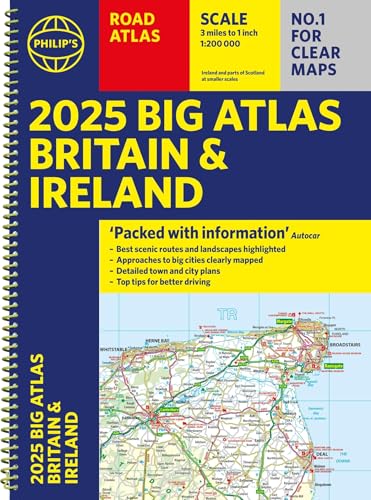
The latest supersize A3 2025 Philip's Big Road Atlas of Britain and Ireland has a special lie-flat spiral binding and fully updated mapping from the Philip's digital database. The super-clear maps have been voted Britain's clearest and most detailed in an independent consumer survey.
The feel-good place to buy books
- Free delivery in Ireland
- Supporting authors with AuthorSHARE
- 100% recyclable packaging
- Proud to be a B Corp – A Business for good
- Buy-back with Ziffit
2025 Philip's Big Road Atlas of Britain & Ireland by Philip's Maps
'Good balance between detail and clarity with excellent town maps' What Car? PHILIP'S is No. 1 in the UK for clear maps. The latest 2025 Philip's Big Road Atlas of Britain and Ireland, in a supersize large format, has fully updated mapping from the Philip's digital database alongside all the detail and information needed for successful travel. * Top driving tips for safety and skill including how to parallel park * The best scenic routes, natural features and landscape highlighted for enhanced travelling * Practical 'more to view per page' A3 size * Main scale of maps: 3 miles to 1 inch = 1:200,000 for ease of use * Route-planning section for the easiest navigation * Special wide-vehicle access indicators for rural areas * 64 fully indexed and detailed town and city plans * City approach maps with named roads for the best access with the latest ULEZ clearly outlined * Clear road map showing all of Ireland 2025 Philip's Big Road Atlas of Britain and Ireland contains 96 pages of road maps covering Britain at 3 miles to 1 inch (Scottish Highlands and Western Isles at 4 miles to 1 inch, Orkney and Shetland at 5.25 miles to 1 inch). The maps clearly mark service areas, roundabouts and multi-level junctions for easy navigation, and in rural areas distinguish between roads over and under 4 metres wide, to help wide vehicles. There are extra-detailed town plans for easy navigation with all counties marked for clarity. The atlas also includes a 2-page road map of Ireland, route-planning maps, a distance table, and 12 large-scale city approach maps with named arterial roads. Wherever you are driving in Britain or Ireland, this is the ultimate road companion.
Good balance between detail and clarity with excellent town maps * What Car? *
Philip's has been at the forefront of creating maps and atlases since 1834. Whether a local street map or a fact-packed World Atlas, we use the most up-to-date technology, expertise and our global network to ensure our customers have all the information they need.
| SKU | Unavailable |
| ISBN 13 | 9781849076647 |
| ISBN 10 | 1849076642 |
| Title | 2025 Philip's Big Road Atlas of Britain & Ireland |
| Author | Philip's Maps |
| Series | Philip's Road Atlases |
| Condition | Unavailable |
| Binding Type | Spiral bound |
| Publisher | Octopus Publishing Group |
| Year published | 2024-06-06 |
| Number of pages | 168 |
| Cover note | Book picture is for illustrative purposes only, actual binding, cover or edition may vary. |
| Note | Unavailable |