Insight Guides Travel Maps Germany


Insight Guides Travel Maps Germany
Regular price
Checking stock...
Regular price
Checking stock...
Summary
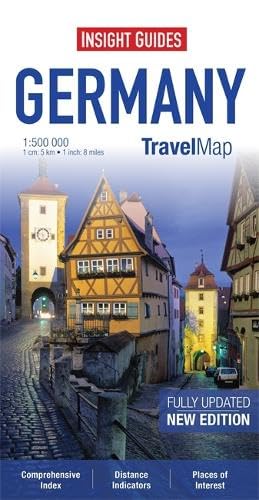
Includes a map of the Ruhr at 1:300 000. In addition to the road and rail networks, ferry routes and airports, this map provides an overview of the topography through the use of relief shading.
The feel-good place to buy books
- Free delivery in Ireland
- Supporting authors with AuthorSHARE
- 100% recyclable packaging
- Proud to be a B Corp – A Business for good
- Buy-back with Ziffit
Insight Guides Travel Maps Germany by Apa Publications Limited
Travel Map Germany is an indexed, road map now available at the more detailed scale of 1:500 000. Also included is a map of the Ruhr at 1:300 000. Places of interest, including museums, monuments and religious sites are listed and accompanied by a wide range of pictorial symbols for instant recognition, these symbols have been colour coded by category. In addition to the road and rail networks, ferry routes and airports, this map provides an overview of the topography through the use of relief shading. National parks, nature reserves and restricted areas are clearly shown. Handy distance indicators, located in the margin, give distances to the nearest town, major locations and motorway junction, if applicable. Intermediate driving distances are shown on main roads. The extensive legend is shown in 4 languages.| SKU | Unavailable |
| ISBN 13 | 9781780054780 |
| ISBN 10 | 1780054785 |
| Title | Insight Guides Travel Maps Germany |
| Author | Apa Publications Limited |
| Series | Insight Guides Travel Maps |
| Condition | Unavailable |
| Publisher | APA Publications |
| Year published | 2013-04-04 |
| Number of pages | 2 |
| Cover note | Book picture is for illustrative purposes only, actual binding, cover or edition may vary. |
| Note | Unavailable |