Philip's Street Atlas Denbighshire, Flintshire and Wrexham


Philip's Street Atlas Denbighshire, Flintshire and Wrexham
Regular price
Checking stock...
Regular price
Checking stock...
Summary
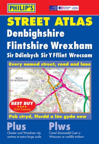
This atlas includes complete coverage of Denbighshire, Flintshire and Wrexham. It includes postcodes on mapping and a two-colour index. Each map contains details of emergency services, farms, public buildings and car parks.
The feel-good place to buy books
- Free delivery in Ireland
- Supporting authors with AuthorSHARE
- 100% recyclable packaging
- Proud to be a B Corp – A Business for good
- Buy-back with Ziffit
Philip's Street Atlas Denbighshire, Flintshire and Wrexham by Unknown
This atlas includes complete coverage of Denbighshire, Flintshire and Wrexham. It includes postcodes on mapping and a two-colour index. Each map contains details of emergency services, farms, public buildings and car parks.
'Best Buy' *****AUTO EXPRESS
| SKU | Unavailable |
| ISBN 13 | 9780540085903 |
| ISBN 10 | 0540085901 |
| Title | Philip's Street Atlas Denbighshire, Flintshire and Wrexham |
| Author | Philip's Maps |
| Series | Philip's Street Atlases |
| Condition | Unavailable |
| Binding Type | Paperback |
| Publisher | Octopus Publishing Group |
| Year published | 2004-04-05 |
| Number of pages | 176 |
| Cover note | Book picture is for illustrative purposes only, actual binding, cover or edition may vary. |
| Note | Unavailable |