Rand McNally 2019 Easyfinder Midsize Road Atlas


Rand McNally 2019 Easyfinder Midsize Road Atlas
Regular price
Checking stock...
Regular price
Checking stock...
Proud to be B-Corp
Our business meets the highest standards of verified social and environmental performance, public transparency and legal accountability to balance profit and purpose. In short, we care about people and the planet.
The feel-good place to buy books
- Free delivery in Ireland
- Supporting authors with AuthorSHARE
- 100% recyclable packaging
- Proud to be a B Corp – A Business for good
- Buy-back with Ziffit
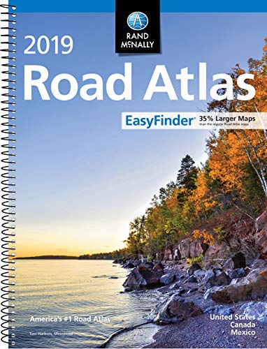
Rand McNally 2019 Easyfinder Midsize Road Atlas by Rand Mcnally
This spiral bound format features maps that are 35% larger than those found in Rand McNally's standard Midsize Atlas. This updated North American atlas contains maps of every U.S. state and Canadian province, an overview map of Mexico, plus detailed maps of over 50 North American cities, all conveniently packaged for travel. Contains mileage chart showing distances between 77 cities and national parks with driving times map. Spiral binding allows the book to lay open easily.Rand McNally presents five of our favorite national parksbig and small, east and westthat showcase this country's astonishing beauty, highlight essential visitor information, and offer insightful travel tips.
Road construction and conditions phone numbers and websites
Tourism websites and phone numbers for every U.S. state and Canadian province on map pages
| SKU | Unavailable |
| ISBN 13 | 9780528019654 |
| ISBN 10 | 0528019651 |
| Title | Rand McNally 2019 Easyfinder Midsize Road Atlas |
| Author | Rand Mcnally |
| Condition | Unavailable |
| Binding Type | Paperback |
| Publisher | Rand Mcnally |
| Year published | 2018-04-16 |
| Number of pages | 160 |
| Cover note | Book picture is for illustrative purposes only, actual binding, cover or edition may vary. |
| Note | Unavailable |