Radstadter Tauern - Katschberg - Lungau Hiking + Leisure Map 1:50 000


Radstadter Tauern - Katschberg - Lungau Hiking + Leisure Map 1:50 000
Regular price
Checking stock...
Regular price
Checking stock...
Résumé
freytag & berndt maps are available for many countries and regions in the world. In addition to the precise cartography each map also includes a lot of additional information about the region covered.
The feel-good place to buy books
- Free delivery in the UK
- Supporting authors with AuthorSHARE
- 100% recyclable packaging
- B Corp - kinder to people and planet
- Buy-back with World of Books - Sell Your Books
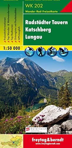
Radstadter Tauern - Katschberg - Lungau Hiking + Leisure Map 1:50 000 by Freytag And Berndt
Freytag & Berndt hiking maps are the perfect companion for hiking, mountaineering and ski touring, thanks to detailed digital cartography and precise yardsticks. They are regularly revised and contain updated information on hiking trails, cycling and mountain biking trails, huts, natural monuments, cultural attractions and leisure facilities. The enclosed information booklet contains a selection of the best hiking trails, cycle paths and mountain bike trails as well as a short description of the individual municipalities with their leisure time activities. (Language: German) Leisure information, hiking and long-distance hiking trails, mountain biking and cycling tours, local register with zip codes, GPS-capable, via ferrata, ski route, cross-country route, Nordic walking trail; Region: Murtal, Radstadt Tauern, Katschberg, Nockberge, Lungau, Ponau, Salzburg, Maltatal, Carinthia Special hiking theme trails: Rupertiweg, Leonhardsweg, Arnoweg, Salzburger Almenweg, Styrian national hiking trail, nature trail Malteiner Wasserspiele, Landwierseen Special cycling and mountain bike tours: Murradweg, Enns Cycle Path, Rieding Route, Preber Route, Hinterlahn Route, Three Lakes Tour.| SKU | Non disponible |
| ISBN 13 | 9783850847179 |
| ISBN 10 | 3850847179 |
| Titre | Radstadter Tauern - Katschberg - Lungau Hiking + Leisure Map 1:50 000 |
| Auteur | Freytag And Berndt |
| État | Non disponible |
| Éditeur | Freytag-Berndt |
| Année de publication | 2018-12-01 |
| Nombre de pages | 1 |
| Note de couverture | La photo du livre est présentée à titre d'illustration uniquement. La reliure, la couverture ou l'édition réelle peuvent varier. |
| Note | Non disponible |