Sea Charts of the British Isles


Sea Charts of the British Isles
Regular price
Checking stock...
Regular price
Checking stock...
Proud to be B-Corp
Our business meets the highest standards of verified social and environmental performance, public transparency and legal accountability to balance profit and purpose. In short, we care about people and the planet.
The feel-good place to buy books
- Free delivery in the UK
- Supporting authors with AuthorSHARE
- 100% recyclable packaging
- B Corp - kinder to people and planet
- Buy-back with World of Books - Sell Your Books
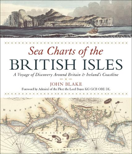
Sea Charts of the British Isles by John Blake
Travelling along the British coastline, Sea Charts of the British Isles showcases a beautiful collection of charts containing a wealth of information about Britain's maritime history and the story of charting and surveying itself. The great names in British chart-making are all included, such as Captain Greenvile Collins, Professor Murdoch Mackenzie and his nephew of the same name, Graeme Spence and William Bligh who between them created the first structured attempts to survey and chart particular areas of the coast of mainland Britain as well as the more remote islands. Examples include several from Collins' 'Great Britain's Coastal Pilot', such as charts of Edinburgh and the Forth, the Orkney Islands, the coast of Ireland and the River Thames; the Chart of the Coast of Wales in St George's Channel and that of Milford Haven by Lewis Morris; The River Clyde and Glasgow by John Watt; and the Observation by Trinity House Pilots and Surveyors of the Downs covering the coast of Kent and the Goodwin Sands, as well as charts by other well-known European chart-makers such as the magnificent example of the Coast of England from Dover to the Isle of Wight showing the Cinque Ports by Lucas Janszoon Wagenaer that dates from 1583. The author has researched maritime archives such as the Admiralty Library, the National Maritime Museum, the Pepys Library, the UK Hydrographic Office and the National Archives to reveal their unseen nautical records and portray the development of the sea chart.
The book takes the reader on a tour of the British IslesThe pages are large enough to show the finer details of the maps. All in all, a lovely piece of work which would make a great gift for a seafarer. * Nautilus Telegraph *
Travelling the ports, harbours, dockyards, naval bases and beaches that fringe these isles, this hardback shows off a beautiful collection of charts. Also contains interesting details on maritime history and the story of charting and surveying. * Lifeboat *
This beautiful book, packed with wonderful sea charts going back to the days when cartographers were artists as much as surveyors, is no mere coffee table book, but an important study of our maritime heritage. * Pembrokeshire Life *
Showcases a collection of charts and a wealth of information about Britain's maritime history. * Western Telegraph *
The award for the most lavishly-produced book received at the Navy News offices this month must surely go to John Blake’s beautiful Sea Charts of the British Isles. * Navy News *
John Blake is a competent interpreter of academic research for the enjoyment of a general readership, young or old. … this follow-on (from The Sea Chart) is equally as fascinating and provides a clear insight into charting over the centuries. -- Geoffrey Haskins * The Hydrographic Journal *
Lieutenant-Commander John Blake, FRIN, spent twelve years in the Royal Navy. He has worked extensively with the UK Hydrographic Office, the producers of Admiralty Charts, and is a Fellow of the Royal Institute of Navigation. John is the author of the acclaimed The Sea Chart (new edition 2016), Charts of War (2006) and Titanic: a Passenger's Guide (2011). His research interests span the maritime world, from nautical charts and surveying to merchant shipping.
| SKU | Non disponible |
| ISBN 13 | 9781472944900 |
| ISBN 10 | 1472944909 |
| Titre | Sea Charts of the British Isles |
| Auteur | John Blake |
| État | Non disponible |
| Type de reliure | Paperback |
| Éditeur | Bloomsbury Publishing PLC |
| Année de publication | 2016-12-15 |
| Nombre de pages | 128 |
| Note de couverture | La photo du livre est présentée à titre d'illustration uniquement. La reliure, la couverture ou l'édition réelle peuvent varier. |
| Note | Non disponible |