

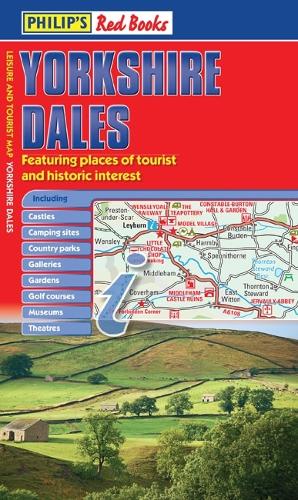
Philip's Yorkshire Dales by Philip's Maps
This leisure and tourist map of the Yorkshire Dales gives detailed coverage of the area's road network at a scale of approximately 2 miles to 1 inch. The map shows places of tourist and historic interest, including castles, camping sites, country parks, galleries, gardens, golf courses, marinas, museums, nature trails, historic sites, sports venues, theatres, theme parks, wildlife parks and zoos. An index to principal places of interest is also featured. In a convenient folded format, this single-sided sheet map is ideally suited for both leisure and business use, whether by locals or visitors.| SKU | Unavailable |
| ISBN 13 | |
| ISBN 10 | |
| Title | Philip's Yorkshire Dales |
| Author | Philip's Maps |
| Series | |
| Condition | Unavailable |
| Binding Type | |
| Publisher | |
| Year published | |
| Number of pages | |
| Cover note | Book picture is for illustrative purposes only, actual binding, cover or edition may vary. |
| Note | Unavailable |
View All Editions
Filter
Applied Filters (0)
Sort by:
Loading editions...