


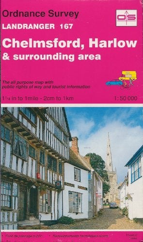
Landranger Maps by Ordnance Survey
This map is part of the Landranger (Pink) series and is designed for people who really want to get to know an area. It includes the following information: tourist information, camping and caravan sites, picnic areas and viewpoints, selected places of interest and rights of way information for England and Wales. Each map in the series covers an area of 40 km by 40 km (25 miles by 25 miles) and like other Ordnance Survey maps, National Grid squares are provided so that any feature can be given a unique reference number. Perfect for planning ahead and local excursions, these maps are full of useful information that will help you really get to know an area.-
 Anglesey
-
 Snowdon & Caernarfon
-
 Isle of Man
-
 Chichester & the South Downs
-
 North Skye, Dunvegan & Portree
-
 North West Norfolk, King's Lynn & Fakenham
-
 Buxton & Matlock, Chesterfield, Bakewell & Dove Dale
-
 Berwick-Upon-Tweed
-
 Dorchester & Weymouth, Cerne Abbas & Bere Regis
-
 Orkney - Mainland
-
 Exeter & Sidmouth, Exmouth & Teignmouth
-
 Worcester & the Malverns, Evesham & Tewkesbury
-
 Penrith & Keswick
-
 Ludlow & Church Stretton, Wenlock Edge
-
 St Davids & Haverfordwest
-
 Porthmadog & Dolgellau
-
 West Lewis & North Harris
-
 Grantown, Aviemore & Cairngorm Mountains
-
 The Black Mountains
-
 Bournemouth & Purbeck, Wimborne Minster & Ringwood
-
 Stornoway & North Lewis
-
 Alnwick and Morpeth, Rothbury and Amble
-
 The Solent & the Isle of Wight, Southampton & Portsmouth
-
 Barra and South Uist, Vatersay and Eriskay
-
 Leeds & Bradford, Harrogate & Ilkley
-
 Lleyn Peninsula
-
 Brighton & Lewes, Haywards Heath
-
 North West Norfolk
-
 Gairloch & Ullapool, Loch Maree
-
 Benbecula and South Uist
-
 Blackburn & Burnley, Clitheroe & Skipton
-
 Reading, Windsor, Henley-on-Thames & Bracknell
-
 Winchester & Basingstoke, Andover & Romsey
-
 Hereford & Leominster, Bromyard & Ledbury
-
 South Skye & Cuillin Hills
-
 Swansea & Gower, Carmarthen
-
 Shrewsbury & Oswestry
-
 Oxford, Chipping Norton & Bicester
-
 Taunton & Lyme Regis, Chard & Bridport
-
 Sound of Harris, North Uist, Taransay & St Kilda
-
 Tenby & Pembroke
-
 Nottingham & Loughborough, Melton Mowbray


Ordnance Survey is Britain's national mapping agency, responsible for the official, definitive mapping of the whole country. They produce and market a wide range of maps for educational and leisure purposes, as well as producing computer data products for government, business and administrative use.
| SKU | Unavailable |
| ISBN 13 | 9780319221679 |
| ISBN 10 | 0319221679 |
| Title | Landranger Maps |
| Author | [Ordnance Survey] |
| Series | Os Landranger Map |
| Condition | Unavailable |
| Binding Type | Sheet map, folded |
| Publisher | Ordnance Survey |
| Year published | 1992-12-01 |
| Cover note | Book picture is for illustrative purposes only, actual binding, cover or edition may vary. |
| Note | Unavailable |