Philip's Germany and Netherlands Road Map


Philip's Germany and Netherlands Road Map
Regular price
Checking stock...
Regular price
Checking stock...
The feel-good place to buy books
- Free UK delivery over £5
- 10% off preloved books when you join +Plus
- Buying preloved emits 46% less CO2 than new
- Give your books a new home - sell them back to us!
Philip's Germany and Netherlands Road Map by Philip's Maps
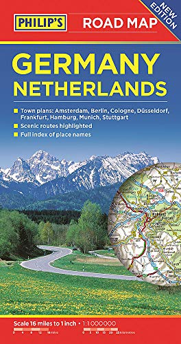
PHILIP'S BEST-SELLING RANGE OF BRITISH AND EUROPEAN MAPS 'The clearest and most detailed maps of Europe' David Williams MBE, CEO, Gem Motoring Assist. - The perfect planning maps for your trip to Germany and the Netherlands - Scale 16 miles to 1 inch = 1:1,000,000 - Double-sided folded map with full index of place names - Super-clear mapping - All major routes shown - Town plans: Amsterdam, Berlin, Cologne, Dusseldorf, Frankfurt, Hamburg, Munich and Stuttgart - Scenic routes - AutoRoute junctions, restricted junctions, toll motorways and pre-pay motorways - Mountain passes and gradients - Tourist attractions
Philip's has been at the forefront of creating maps and atlases since 1834. Whether a local street map or a fact-packed World Atlas, we use the most up-to-date technology, expertise and our global network to ensure our customers have all the information they need.
| SKU | Unavailable |
| ISBN 13 | 9781849074407 |
| ISBN 10 | 1849074402 |
| Title | Philip's Germany and Netherlands Road Map |
| Author | Philip's Maps |
| Series | Philip's Sheet Maps |
| Condition | Unavailable |
| Binding Type | Paperback |
| Publisher | Octopus Publishing Group |
| Year published | 2017-03-09 |
| Number of pages | 2 |
| Cover note | Book picture is for illustrative purposes only, actual binding, cover or edition may vary. |
| Note | Unavailable |