

Road Atlas South Africa by Map Studio
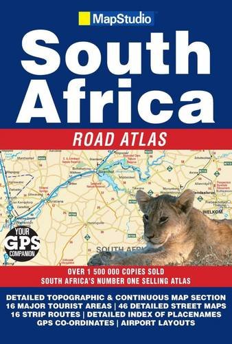
34 Page detailed, topographic, continuous map section at 1:1 250 000: Map content information centres & police stations; major, main, tarred & untarred roads; places of interest and historic sites; main & minor roads in detail; National Parks and reserves; selected accommodation airports and airfields; schools & hospitals; distance markers; railway stations; shipwreck sites; detailed index to place names; airport maps wine estates; toll roads; battlesites; road signs. 16 Detailed major tourist area maps: Cape Peninsula; South Western Cape; Overberg; Garden Route Eastern Cape; Kwazulu-Natal Coastline; Drakensberg; Midlands Meander; Kwazulu-Natal Battlefields; St Lucia (Isimangaliso); Umfolozi Hluhluwe Region; Gauteng Region; Magaliesburg; Suncity & Pilanesberg; Kruger National Park. 46 Detailed street maps: Cape Town; Stellenbosch; Langebaan; Simonstown; Worcester; Swellendam; Oudtshoorn; George; Mossel Bay; Knysna; Plettenberg Bay; Upington; Port Elizabeth; Grahamstown; Port Alfred; East London; Bhisho; Mthatha; Durban; Margate; Richards Bay; Ladysmith Ulundi; Kimberley; Bloemfontein; Welkom; Kroonstad; Klerksdorp; Potchefstroom; Johannesburg 'Ring Road' Regional; Johannesburg Central; Rosebank & Sandton (JHB); Midrand; Pretoria; Hartbeespoort Mafikeng; Rustenberg; Polokwane; Witbank (Emalahleni) | Nelspruit White River; Phalaborwa.16 Strip routes & distance table. Accurate and easy-to-use strip routes; 3 Airport maps; Layouts of O.R. Tambo, King Shaka & Cape Town airports; Gps Co-Ordinates for Major Road Junctions. GPS Co-Ordinates for Junctions & all satellite towns; Latest Xhosa & Zulu spellings, and all new names; Best Atlas Scale (1:1 250 000); Most South African street maps Available In One Publication; most strip routes available in one publication in South Africa; contains a detailed continuous road atlas section of the country; includes detailed street and tourist maps; road sign information presented in an easy-to-use way; part of a series of highly successful road atlases; our road atlas has been in print for over 25 years; more than 1:500 000 copies of our road atlas South Africa sold; we have a full-time a research department doing ongoing research; we have access to accurate data via mapit & teleatlas South Africa.| SKU | Unavailable |
| ISBN 13 | 9781770261549 |
| ISBN 10 | 1770261540 |
| Title | Road Atlas South Africa |
| Author | Map Studio |
| Condition | Unavailable |
| Binding Type | Paperback |
| Publisher | Penguin Random House South Africa |
| Year published | 2010-08-01 |
| Number of pages | 100 |
| Cover note | Book picture is for illustrative purposes only, actual binding, cover or edition may vary. |
| Note | Unavailable |