

Wyoming Recreation Map by Benchmark Maps
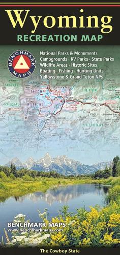
One side provides a full state map that features Public & Tribal Lands, extensive highway detail, point-to-point mileages, recreation attractions, campgrounds, parks and wildlife areas, fishing access points, and hunting units (GMU). The reverse side features enlarged maps of Central Yellowstone and Grand Teton / Jackson, and includes statewide categorized POI listings with helpful descriptions, current contact information, and map grid references.National Geographic Maps was founded in 1915 as the Cartographic Group, the National Geographic Society's original branch, with the purpose of depicting the world around us through the art and science of mapmaking. Today, National Geographic Maps continues this mission by producing the best wall maps, recreation maps, atlases, and globes that inspire people to care about and explore the world around them. The Society's non-profit objective is to expand global awareness and encourage conservation of our planet through exploration, research, and education, and all proceeds from the sale of National Geographic maps support that mission.
| SKU | Unavailable |
| ISBN 13 | 9780783499741 |
| ISBN 10 | 0783499744 |
| Title | Wyoming Recreation Map |
| Author | Benchmark Maps |
| Condition | Unavailable |
| Publisher | Benchmark Maps |
| Year published | 2025-04-01 |
| Number of pages | 2 |
| Cover note | Book picture is for illustrative purposes only, actual binding, cover or edition may vary. |
| Note | Unavailable |