
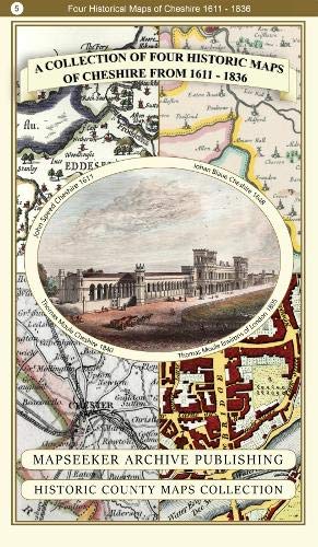
A Cheshire 1611 - 1840 - Fold Up Map that features a collection of Four Historic Maps, John Speed's County Map 1611, Johan Blaeu's County Map of 1648, Thomas Moules County Map of 1840 and Cole and Roper's Plan of the City of Chester 1805.


Regular price
Regular price
Checking stock...
| SKU | Unavailable |
| ISBN 13 | |
| ISBN 10 | |
| Title | A Cheshire 1611 - 1840 - Fold Up Map that features a collection of Four Historic Maps, John Speed's County Map 1611, Johan Blaeu's County Map of 1648, Thomas Moules County Map of 1840 and Cole and Roper's Plan of the City of Chester 1805. |
| Author | Mapseeker Archive Publishing Ltd Mapseeker Archive Publishing Ltd |
| Series | |
| Condition | Unavailable |
| Binding Type | |
| Publisher | |
| Year published | |
| Number of pages | |
| Cover note | Book picture is for illustrative purposes only, actual binding, cover or edition may vary. |
| Note | Unavailable |
View All Editions
Filter
Applied Filters (0)
Sort by:
Loading editions...