

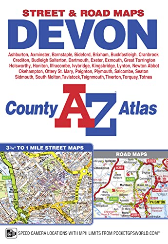
Devon A-Z County Atlas by A-Z Maps
This A-Z map of Devon is a full colour, paperback county atlas featuring 150 pages of street mapping covering all major towns and villages within Devon. In addition, there are large scale city/town centre maps of Exeter, Plymouth and Dartmouth and 17 pages of road mapping covering the whole county. Postcode districts, one-way streets, safety camera locations with speed limits and park and ride sites are featured on the street mapping. The index section lists streets; selected flats, walkways and places of interest; place, area and station names. There is a separate list of hospitals, NHS Minor Injury Units and hospices covered by this atlas.| SKU | Unavailable |
| ISBN 13 | |
| ISBN 10 | |
| Title | Devon A-Z County Atlas |
| Author | A-Z Maps |
| Series | |
| Condition | Unavailable |
| Binding Type | |
| Publisher | |
| Year published | |
| Number of pages | |
| Cover note | Book picture is for illustrative purposes only, actual binding, cover or edition may vary. |
| Note | Unavailable |
View All Editions
Filter
Applied Filters (0)
Sort by:
Loading editions...