


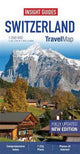
Insight Travel Maps: Switzerland by Apa Publications Limited
Travel Map Switzerland is a double-sided, indexed, road map at 1:200 000. It includes detailed city plans of Basel, Bern, Geneva, Lausanne, Lucerne, St Gallen and Zurich. In addition to the road and rail networks, ferry routes and airports, this map provides an overview of the topography through the use of relief shading, with mountain ranges named and peak heights given. Mountain passes show gradients for steep ascents and roads closed to motor vehicles are clearly marked. Places of interest, including castles and ruins, churches, museums and heritage sites are highlighted. Handy distance indicators, located in the margin, give distances to the nearest town, major locations and motorway junction, if applicable. Intermediate driving distances are marked on main roads. The extensive legend is shown in 8 languages.| SKU | Unavailable |
| ISBN 13 | |
| ISBN 10 | |
| Title | Insight Travel Maps: Switzerland |
| Author | Apa Publications Limited |
| Series | |
| Condition | Unavailable |
| Binding Type | |
| Publisher | |
| Year published | |
| Number of pages | |
| Cover note | Book picture is for illustrative purposes only, actual binding, cover or edition may vary. |
| Note | Unavailable |
View All Editions
Filter
Applied Filters (0)
Sort by:
Loading editions...