
Jotunheimen: Besseggen & Bygdin - Hoyfjellskart


Regular price
Regular price
Checking stock...

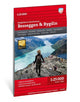
Jotunheimen: Besseggen & Bygdin - Hoyfjellskart by Calazo Forlag
This is one of five unique maps with a wealth of detail that has never before been shown over Jotunheimen. The terrain information in the map is based on laser scanning from aircraft. Mountain slopes, waterways, glaciers and other natural elements are shown in much more detail with this technology. The map also contains more trails than any previous map over the same area. A map on a scale of 1:25,000 is useful for those of you who are planning a trip over Besseggen, a summit trip to Tjonnholstinden (2331 masl.) or to Kalvehogde (2209 masl.). The map can also be used by those who wish to leave marked paths to explore their own routes in the high mountains.| SKU | Unavailable |
| ISBN 13 | |
| ISBN 10 | |
| Title | Jotunheimen: Besseggen & Bygdin - Hoyfjellskart |
| Author | Calazo Forlag |
| Series | |
| Condition | Unavailable |
| Binding Type | |
| Publisher | |
| Year published | |
| Number of pages | |
| Cover note | Book picture is for illustrative purposes only, actual binding, cover or edition may vary. |
| Note | Unavailable |
View All Editions
Filter
Applied Filters (0)
Sort by:
Loading editions...