British Isles Communication


British Isles Communication
Regular price
Checking stock...
Regular price
Checking stock...
Summary
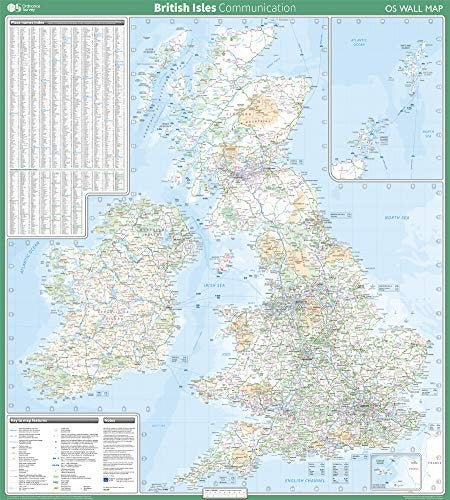
This map shows the British isles, with all the major road, rail and sea connections. It is supplied rolled in a tube and is ideal for schools, students or just for decoration. It includes an index of place names. This map is gloss coated, so can be written on with suitable dry-wipe pens. It's scale is 1: 1 000 000
The feel-good place to buy books
- Free US shipping over $15
- Buying preloved emits 41% less CO2 than new
- Millions of affordable books
- Give your books a new home - sell them back to us!
British Isles Communication by Ordnance Survey
This map shows the British isles, with all the major road, rail and sea connections. It is supplied rolled in a tube and is ideal for schools, students or just for decoration. It includes an index of place names. This map is gloss coated, so can be written on with suitable dry-wipe pens. It's scale is 1: 1 000 000| SKU | Unavailable |
| ISBN 13 | 9780319148440 |
| ISBN 10 | 0319148440 |
| Title | British Isles Communication |
| Author | Ordnance Survey |
| Series | Os Wall Map |
| Condition | Unavailable |
| Binding Type | Sheet map, rolled |
| Publisher | Ordnance Survey |
| Year published | 2019-05-08 |
| Cover note | Book picture is for illustrative purposes only, actual binding, cover or edition may vary. |
| Note | Unavailable |