Ecuador and Galapagos Islands Map


World of Books
The feel-good place to buy books
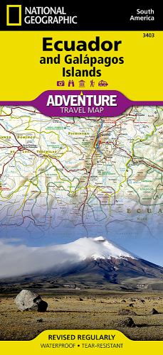
Ecuador and Galapagos Islands Map by Nat Geo Maps
• Waterproof • Tear-Resistant • Travel MapNational Geographic's Ecuador and Galapagos Islands Adventure Map, with its comprehensive information, is uniquely designed for adventure travelers. The map delivers unparalleled detail of the entire country and its recreational, historical, cultural and natural destinations. Pinpointed spots include beaches, wildlife areas, archeological sites, churches and areas for camping, surfing, fishing and diving. A list of cities and towns with a user-friendly index is provided along with a road network of highways, major and secondary roads, shown with distances. Unsurfaced and 4-wheel-drive roads are mapped for those wishing to get off the beaten track. Other displayed travel aids include airports, airfields, harbors, anchorage sites, railroads, ferry routes and border crossings with neighboring Colombia and Peru. The northern part of the map covers the capital city of Quito, Cotopaxi Volcano and National Park, Cuyabeno Wildlife Reserve, the town of Tena in the Amazon rainforest and the country's largest city of Guayaquil. The southern part of the map covers from Guayaquil to the southern and southeastern border with Peru, showing the diverse Podocarpus National Park in the southern Andes and Amazonian ecological systems. An inset map covers the world renowned Galapagos Islands, showing Galapagos National Park and Marine Reserve, Tortoise Reserve and diving areas around the islands. This expertly researched map is the perfect complement to any guidebook.Every Adventure Map is printed on durable synthetic paper, making them waterproof, tear-resistant and tough — capable of withstanding the rigors of international travel.
Founded in 1915 as the Cartographic Group, the first division of the National Geographic Society, National Geographic Maps has been responsible for illustrating the world around us through the art and science of mapmaking. Today, National Geographic Maps continues this mission by creating the world's best wall maps, recreation maps, atlases, and globes which inspire people to care about and explore their world. All proceeds from the sale of National Geographic maps go to support the Society's non-profit mission to increase global understanding and promote conservation of our planet through exploration, research, and education.
| SKU | Unavailable |
| ISBN 13 | 9781566955478 |
| ISBN 10 | 1566955475 |
| Title | Ecuador and Galapagos Islands Map |
| Author | Nat Geo Maps |
| Condition | Unavailable |
| Binding Type | Sheet map, folded |
| Publisher | National Geographic Maps |
| Year published | 2011-04-27 |
| Number of pages | 1 |
| Cover note | Book picture is for illustrative purposes only, actual binding, cover or edition may vary. |
| Note | Unavailable |