

Handy Map Dublin by
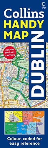
3.5 inches to 1 mile 1:18,000 approx. This full colour map featuring clear, colourful cartography with street level detail and index to streets has a unique easy to use folding system and has a durable laminated surface. These innovative maps with their distinctive fold are extremely easy to use. It is almost like using an atlas, with the benefits of a map. Each map is laminated for extra protection and is presented in a plastic wallet. The maps divide the city into sections and a colour-coding system ensures that the desired area is easily found. The map featues: • Clear, full colour mapping. • Unique ‘easyfold’ pattern. • Colour coded map areas. • Durable laminated map in a clear plastic wallet. • Index to street names. • Includes all important buildings and places of interest. The map covers an area from Chapelizod and Phoenix Park in the west to Dollymount in the east and from Glasnevin in the north to Milltown in the south. This map is essential for the visitor and tourist exploring the city of Dublin.| SKU | Unavailable |
| ISBN 13 | 9780007254637 |
| ISBN 10 | 0007254636 |
| Title | Handy Map Dublin |
| Condition | Unavailable |
| Binding Type | Sheet map, folded |
| Publisher | HarperCollins Publishers |
| Year published | 2008-02-04 |
| Cover note | Book picture is for illustrative purposes only, actual binding, cover or edition may vary. |
| Note | Unavailable |