

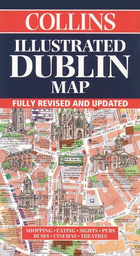
Illustrated Map Dublin by Dominic Beddow
Dublin’s most original map – delightful water-coloured mapping and large-scale plans of the city centre, shopping and entertainment areas. Scale: 1:6,000/11 inches to 1 mile Format: 205 x 112mm (folded); 594 x 816 (flat) Comprehensive index. Car parks, one-way streets, taxi ranks and bus routes. Individual paintings of all the main sights and landmarks. Historical and contemporary anecdotes. Day trips and city walks. Shop by shop street maps. OTHER TITLES IN THE SERIES Illustrated Edinburgh Map Illustrated London Map
Collins Maps: -
Explore the world through accurate and up-to-date mapping.
| SKU | Unavailable |
| ISBN 13 | 9780004489285 |
| ISBN 10 | 0004489284 |
| Title | Illustrated Map Dublin |
| Author | Beddow Dominic |
| Condition | Unavailable |
| Binding Type | Sheet map, folded |
| Publisher | HarperCollins Publishers |
| Year published | 1999-02-01 |
| Number of pages | 1 |
| Cover note | Book picture is for illustrative purposes only, actual binding, cover or edition may vary. |
| Note | Unavailable |