Jasper North Map (Jasper National Park)


World of Books
The feel-good place to buy books
Jasper North Map (Jasper National Park) by Nat Geo Maps
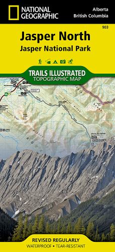
• Waterproof • Tear-Resistant • Topographic MapThe largest park in the Canadian Rockies, Jasper National Park is a UNESCO World Heritage Site with breathtaking mountain scenery and bountiful recreational opportunities. Expertly researched and created in cooperation with Parks Canada and others, National Geographic's Trails Illustrated map of Jasper North delivers unparalleled detail of the park from the town of Jasper in the south to its northern boundary. Coverage includes many popular points of interest such as Miette Hot Springs, Maligne Canyon, Pyramid Lake and Mountain, Calumet Glaciers, Celestine Lake and Snake Indian River, as well as the town of Jasper. Also covered are adjacent areas of Rock Lake-Solomon Creek Wildland Park, Mount Robson Provincial Park and Willmore Wilderness Park.Explore the area by following the map to trailheads and then along mapped trails, labeled with distance markers and color-coded according to designated usage, whether hiking, biking or horseback riding. The area's very sparse road network is displayed, including the Yellowhead Highway shown with scenic pullouts and roadside facilities. To aid in your navigation the map shows glaciers and icefields, contour lines and elevations, labeled peaks, summits and passes, water features, rock debris and areas of wooded cover. Some of the recreation feature pinpointed are campgrounds and primitive camps, backcountry lodging and cabins, river access and boat launch points, horse stables and corrals, cross-country ski areas, interpretive trails and scenic viewpoints. Every Trails Illustrated map is printed on 'Backcountry Tough' waterproof, tear-resistant paper. A full UTM grid is printed on the map to aid with GPS navigation.Other features found on this map include: Calumet Glaciers, Celestine Lake, Jasper, Jasper National Park, Maligne Canyon, Miette Hot Springs, Pyramid Lake, Pyramid Mountain, Snake Indian River.National Geographic Maps was founded in 1915 as the Cartographic Group, the National Geographic Society's original branch, with the purpose of depicting the world around us through the art and science of mapmaking. Today, National Geographic Maps continues this mission by producing the best wall maps, recreation maps, atlases, and globes that inspire people to care about and explore the world around them. The Society's non-profit objective is to expand global awareness and encourage conservation of our planet through exploration, research, and education, and all proceeds from the sale of National Geographic maps support that mission.
| SKU | Unavailable |
| ISBN 13 | 9781566956611 |
| ISBN 10 | 1566956617 |
| Title | Jasper North Map (Jasper National Park) |
| Author | National Geographic Maps |
| Condition | Unavailable |
| Binding Type | Sheet map, folded |
| Publisher | National Geographic Maps |
| Year published | 2012-08-02 |
| Number of pages | 1 |
| Cover note | Book picture is for illustrative purposes only, actual binding, cover or edition may vary. |
| Note | Unavailable |