

Map of UK and Ireland by Schofield And Sims
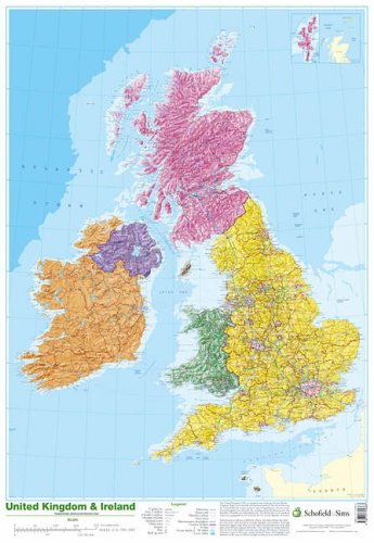
This detailed relief map of the United Kingdom and Ireland is colour coded to show the area of each country and large city. County boundaries are marked, as are rivers, motorways, ports and airports. An explanation of the political relationship between the countries is given, alongside information about the distance from sea level to Ben Nevis.| SKU | Unavailable |
| ISBN 13 | 9780721709383 |
| ISBN 10 | 0721709389 |
| Title | Map of UK and Ireland |
| Author | Schofield And Sims |
| Condition | Unavailable |
| Binding Type | Poster |
| Publisher | Schofield & Sims Ltd |
| Year published | 2002-10-31 |
| Cover note | Book picture is for illustrative purposes only, actual binding, cover or edition may vary. |
| Note | Unavailable |