Northamptonshire A-Z County Atlas


Summary
The feel-good place to buy books
Northamptonshire A-Z County Atlas by Geographers' A-Z Map Co Ltd
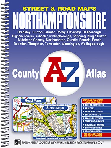
This County Atlas of Northamptonshire contains 126 pages of coloured street mapping featuring all the major towns and villages; 10 pages of road mapping covering the whole county are also included. The street mapping includes coverage of: *Brackley, Brixworth, Burton Latimer, Corby, Daventry, Desborough, Earls Barton, Grange Park, Higham Ferrers, Irchester, Irthlingborough, Kettering, King''s Sutton, Middleton Cheney, Northampton, Oundle, Raunds, Roade, Rothwell, Rushden, Silverstone, Thrapston, Towcester, Warmington and Wellingborough. *Also included is a large scale town centre map of Northampton. Postcode districts, one-way streets and safety camera locations with their maximum speed limit are featured on the street mapping. The index section lists streets, selected flats, walkways and places of interest, place, area and station names. Hospitals, NHS Walk-in Centres and hospices covered by this atlas are listed separately.Britain's leading street map publisher providing cartographic services, digital data products and paper mapping publications (including Street Atlases, Visitors Guides, Great Britain Road Atlases and The Adventure Atlas).
| SKU | Unavailable |
| ISBN 13 | 9781843486923 |
| ISBN 10 | 184348692X |
| Title | Northamptonshire A-Z County Atlas |
| Author | Geographers A-Z Map Co Ltd |
| Condition | Unavailable |
| Binding Type | Spiral bound |
| Publisher | HarperCollins Publishers |
| Year published | 2009-11-11 |
| Number of pages | 176 |
| Cover note | Book picture is for illustrative purposes only, actual binding, cover or edition may vary. |
| Note | Unavailable |