

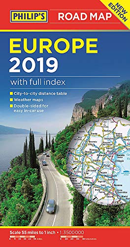
Philip's Europe Road Map by Philip's Maps
'THE CLEAREST AND MOST DETAILED MAPS OF EUROPE' David Williams MBE, CEO Gem Motoring Assist The map for planning your European Road Trip: - Main scale super-clear 1: 3,500,000 (55 miles to 1 inch) - Fully updated - Scenic routes highlighted - Summer and Winter weather maps - Maps on both sides - more for your money - City to City Distance Table - The important information for motoring: motorways (toll, pre-pay and free), mountain passes, railways, road numbers (European and local), distances between towns - Full index of place names - Major city location maps - All the places of interest for your trip: from castles, historic houses, beaches and national parks to theme parks, places of worship and ancient monuments In fact, everything you need for driving in Europe - every country covered
Philip's has been at the forefront of creating maps and atlases since 1834. Whether a local street map or a fact-packed World Atlas, we use the most up-to-date technology, expertise and our global network to ensure our customers have all the information they need.
| SKU | Unavailable |
| ISBN 13 | 9781849074353 |
| ISBN 10 | 1849074356 |
| Title | Philip's Europe Road Map |
| Author | Philip's Maps |
| Series | Philip's Sheet Maps |
| Condition | Unavailable |
| Binding Type | Paperback |
| Publisher | Octopus Publishing Group |
| Year published | 2018-05-03 |
| Number of pages | 2 |
| Cover note | Book picture is for illustrative purposes only, actual binding, cover or edition may vary. |
| Note | Unavailable |