


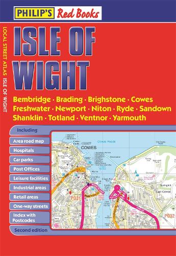
Philip's Isle of Wight by Philip's Maps
This pocket-sized street atlas of the Isle of Wight gives detailed coverage of the whole of the island. This local street atlas of the Isle of Wight gives detailed coverage of the whole of the island at a scale of 2 2/3 inches to 1 mile. Important for ferry links to the Isle of Wight, the mainland towns of Southampton, Gosport, Lymington and Portsmouth are included at the same scale. Central Portsmouth is also shown at the enlarged scale of 5 1/3 inches to 1 mile. The maps show hospitals, car parks, post offices, leisure facilities, schools, industrial areas and retail areas, while the index lists street names and postcodes. Extra contents include an 8-page route-planner, marking all major and minor roads on the island together with an area on the mainland taking in the New Forest to the west and Emsworth to the east, plus a 4-page guide to the top visitor attractions. Pocket sized, and wire stitched so that it opens out flat, the atlas is ideally suited for both business and leisure use, whether by locals or visitors.-
 Philip's Yorkshire Dales
-
 Philip's Highlands of Scotland
-
 Philip's Isle of Wight Guide Book
-
 Philip's Red Books Isle of Man
-
 Philip's Isle of Man
-
 Philip's Red Books Bournemouth
-
 Philip's Red Books Brighton
-
 Philip's Red Books Shrewsbury and Telford
-
 Philip's Red Books Isle of Wight
-
 Philip's Red Books Yorkshire
-
 Philip's Red Books Kent and East Sussex
-
 Philip's Red Books Portsmouth
-
 Philip's Isle of Wight Leisure & Tourist Map
-
 Philip's Outer Hebrides: Leisure and Tourist Map
-
 Philip's Skye and Lochalsh: Leisure and Tourist Map
-
 Philip's Red Books North York Moors
-
 Philip's Red Books Gloucester, Cheltenham, Cirencester and Stroud
-
 Philip's Red Books Winchester and New Alresford
-
 Philip's Red Books Hampshire
-
 Philip's Red Books Ashford and Tenterden
-
 Philip's Isle of Wight Map
-
 Philip's The Cotswolds Leisure and Tourist Map
-
 Philip's Orkney and Shetland: Leisure and Tourist Map
-
 Philip's Red Books Wales
-
 Philip's Red Books Chester and Wrexham
-
 Philip's Red Books Devon
-
 Philip's The Cotswolds


Philip's has been at the forefront of creating maps and atlases since 1834. Whether a local street map or a fact-packed World Atlas, we use the most up-to-date technology, expertise and our global network to ensure our customers have all the information they need.
| SKU | Unavailable |
| ISBN 13 | 9781849073349 |
| ISBN 10 | 1849073341 |
| Title | Philip's Isle of Wight |
| Author | Philip's Maps |
| Series | Philip's Red Books |
| Condition | Unavailable |
| Binding Type | Paperback |
| Publisher | Octopus Publishing Group |
| Year published | 2014-07-07 |
| Number of pages | 88 |
| Cover note | Book picture is for illustrative purposes only, actual binding, cover or edition may vary. |
| Note | Unavailable |