

Scotland Road Map by Geographers' A-Z Map Company
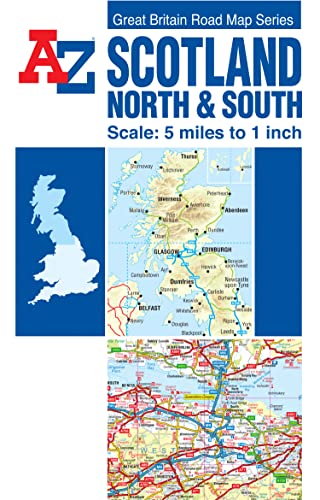
This full colour double sided foldout road map of North and South Scotland is one of a series of five maps covering Great Britain, with a continuous grid referencing system which enables several or all of the sheets to be mounted together, whilst retaining the compatibility of the index. The Northern Scotland map covers the mainland of northern Scotland and includes the Isle of Sky, the Inner Hebrides and the Western Isles. The Orkney and Shetland Islands are featured in an inset map at a scale of approximately 12.5 inches to 1 mile. The Southern Scotland map covers the remainder of Scotland southwards to include a large section of Northern England which includes Berwick-upon-Tweed, Newcastle-upon-Tyne, Middlesbrough, York, Skipton, Fleetwood, Whitehaven and Carlisle. The Isle of Man is also covered. The map information includes motorways open with full junction detail, motorways under construction and proposed, service areas, primary routes and destinations, A and B roads, gradients 1:5 and steeper, tolls, mileages, national and county boundaries, spot heights and hill shading. A selection of ancillary and tourist information is included on the mapping. Attached to the cover is an index booklet which lists cities, towns, villages, hamlets and locations covered by the mapping.Britain’s leading street map publisher providing cartographic services, digital data products and paper mapping publications (including Street Atlases, Visitors Guides, Great Britain Road Atlases and The Adventure Atlas).
| SKU | Unavailable |
| ISBN 13 | 9781843486299 |
| ISBN 10 | 1843486296 |
| Title | Scotland Road Map |
| Author | Geographers' A-Z Map Company |
| Series | A-Z Road Maps And Atlases |
| Condition | Unavailable |
| Publisher | HarperCollins Publishers |
| Year published | 2017-09-27 |
| Number of pages | 1 |
| Cover note | Book picture is for illustrative purposes only, actual binding, cover or edition may vary. |
| Note | Unavailable |