
Western Crete Tour & Trail Super-Durable Map


Summary
The feel-good place to buy books
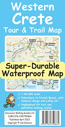
Western Crete Tour & Trail Super-Durable Map by Jan Kostura
For your best adventures, use the best map. Water-proof, split-proof, tear-proof. Western Crete Tour & Trail Super-Durable Map is simply the toughest, most accurate, easy to read, easy to use map that you can buy at any price. A large 960mm by 694mm double sided map sheet at 1:40,000 scale covers area of over 1600km2, from Paleochora in the west to Preveli beach in the east. The map covers the most important hiking regions in the western Crete, including the famous Samaria Gorge, Lefka Ori (White Mountains) and much more. Our legendary 'Tour & Trail' level of detail ranges from major roads to secondary roads to minor roads to streets and narrow country roads, plus dirt roads, tracks and walking trails. Place names are in English and Greek to aid your navigation. Altitude shading is designed to clearly show the altitude range when travelling across the island by car or on foot. 20-metre and 100-metre contours combined with altitude shading bring this beautiful landscape to life. There are plenty of individual height points and all of the official 'Trig' points are on the map. Tour & Trail attention to detail includes our useful symbol range including viewpoints, picnic areas, petrol stations, bar/restaurants and parking areas where you can pull off the road safely. You will easily identify springs, caves, sports grounds, cemeteries, monasteries, churches, chapels, lighthouses, forts, camping areas, waterfalls, wind turbines, windmills, hotels etc. For walkers, the E4 long distance walking route is specially highlighted on the map in red. Published walking routes are highlighted in green. It all adds up to the most detailed, most durable map of Western Crete that you can buy anywhere. 'Super-Durable' means a waterproof, tear-proof, map that can take the roughest treatment and still folds up like new after your adventures. Super-Durable Maps come with a 2-year adventurous use 'Wear and Tear' guarantee. DWG's special concertina map fold makes our map easy to open and easy to refold back to its 232mm by 120mm size. Digital editions of our Western Crete Tour & Trail Map are available as in-app purchases for Outdooractive, Locus Map and Avenza apps| SKU | Unavailable |
| ISBN 13 | 9781782750864 |
| ISBN 10 | 178275086X |
| Title | Western Crete Tour & Trail Super-Durable Map |
| Author | Jan Kostura |
| Condition | Unavailable |
| Binding Type | Paperback |
| Publisher | Discovery Walking Guides Ltd |
| Year published | 2023-05-05 |
| Number of pages | 2 |
| Cover note | Book picture is for illustrative purposes only, actual binding, cover or edition may vary. |
| Note | Unavailable |